| dc.contributor.author | Nahavandchi, Hossein | |
| dc.date.accessioned | 2023-04-19T12:48:04Z | |
| dc.date.available | 2023-04-19T12:48:04Z | |
| dc.date.created | 2004-12-14T11:12:18Z | |
| dc.date.issued | 2004 | |
| dc.identifier.citation | Kart og Plan. 2004, 64 (1), 46-56. | en_US |
| dc.identifier.issn | 0047-3278 | |
| dc.identifier.uri | https://hdl.handle.net/11250/3063861 | |
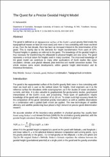
| dc.description.abstract | The geoid is defined as an equipotential surface of the Earth�s actual gravity field inside the topographical masses on land (in most cases) and more or less coinciding with mean sea level at sea. Over the last decade, there has been an increased interest in the determination of the geoid. This is mainly due to the demands for height transformation from users of GPS. Physical heights in geodesy are referred to the geoid. The knowledge of the geoidal height is thus necessary for transforming the ellipsoidal to physical heights and vice versa. The geoid represents a vertical datum for heights used in many countries. The improved knowledge of the geoid model can contribute to many other applications of Earth studies like ocean circulation, climate, post-glacial rebound, plate tectonics and mantle convection studies. This article reviews some recent developments within geoidal height determination and its theoretical limitations. | en_US |
| dc.language.iso | eng | en_US |
| dc.publisher | Universitetsforlaget | en_US |
| dc.title | The Quest for a Precise Geoidal Height Model | en_US |
| dc.title.alternative | The Quest for a Precise Geoidal Height Model | en_US |
| dc.type | Peer reviewed | en_US |
| dc.type | Journal article | en_US |
| dc.description.version | acceptedVersion | en_US |
| dc.source.pagenumber | 46-56 | en_US |
| dc.source.volume | 64 | en_US |
| dc.source.journal | Kart og Plan | en_US |
| dc.source.issue | 1 | en_US |
| dc.identifier.cristin | 426148 | |
| cristin.ispublished | true | |
| cristin.fulltext | postprint | |
| cristin.qualitycode | 1 | |
