| dc.contributor.advisor | Stahl, Annette | |
| dc.contributor.author | Birkeland, Peder Hogstad | |
| dc.date.accessioned | 2019-10-31T15:02:26Z | |
| dc.date.issued | 2019 | |
| dc.identifier | no.ntnu:inspera:35771502:18530478 | |
| dc.identifier.uri | http://hdl.handle.net/11250/2625673 | |
| dc.description.abstract | Denne masteroppgaven tar for seg arbeidet med a utvikle og teste et kamerabasert sensorsystem ˚
for posisjonering av fly og helikoptre i samarbeid med Forsvarets Forskningsinstitutt (FFI).
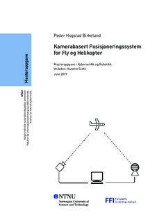
Systemet som er utviklet bestar av to kamera som begge er koblet til en felles datamaskin for ˚
prosessering. Det ene kameraet er et 360°-kamera som kan overvake himmelen i alle retninger ˚
samtidig. Det andre kameraet har et smalere synsfelt og er montert pa et styrbart hode slik at ˚
det kan pekes i alle mulige retninger.
For a hente ut informasjon om flys posisjon fra bildene kameraene produserer kjøres forgrunns- ˚
deteksjon pa bildene fra 360°-kameraet. Denne informasjonen blir s ˚ a brukt til ˚ a styre det andre ˚
kameraet mot malet. Informasjonen fra begge disse kameraene smeltes sammen til ˚ a triangulere ˚
objektets nøyaktige posisjon.
Oppgaven tar for seg de nøyaktige maskinvarekomponentene som ble valgt til a utgjøre systemet ˚
og hvorfor disse er hensiktsmessige til dette bruksomradet. Den inneholder ogs ˚ a en grundig ˚
beskrivelse av de metodene som er tatt i bruk og hvordan disse er implementert i programvare
som er blitt utviklet for dette systemet.
Til sist er systemet blitt testet og dets funksjon og nøyaktighet er analysert. Pa bakgrunn av ˚
denne testen konkluderes det med at systemet i sin naværende form har potensiale, men har ˚
betydelige feil som ma utbedres før systemet kan tas i bruk. | |
| dc.description.abstract | This master thesis concerns the development and testing of a camera based sensor system for
the purpose of positioning aircraft in cooperation with the Norwegian Defence Research Establishment (FFI).
The system consists of two cameras, connected to a shared computer for processing. One camera
is a 360°-camera which can monitor the sky in every direction simultaneously. The other has a
narrower field of view and is mounted to a controllable head such that it may be pointed in any
direction.
Background subtraction is used in order to extract information about the position of aircraft in
the images from the 360°-camera. This information is then used to point the other camera in
the direction of the target. The information produced by both cameras are then fused in order to
triangulate the exact position of the target.
The thesis covers the exact hardware components which were chosen for the system and why
these are appropriate for this use. It also contains a thorough description of the methods the
system utilizes and how these were implemented in the software which was developed for this
platform.
Lastly the system has been tested and its prescision and function has been analyzed. Based on
the results of this test it has been concluded that the system in its current form has potential.
However, it also has considerable flaws which must be improved before the system can be truly
useful. | |
| dc.language | nob | |
| dc.publisher | NTNU | |
| dc.title | Kamerabasert Posisjoneringssystem
for Fly og Helikopter | |
| dc.type | Master thesis | |
