| dc.contributor.advisor | Brekke, Edmund | |
| dc.contributor.author | Ødven, Marius Strand | |
| dc.date.accessioned | 2019-10-15T14:00:15Z | |
| dc.date.available | 2019-10-15T14:00:15Z | |
| dc.date.issued | 2019 | |
| dc.identifier.uri | http://hdl.handle.net/11250/2622320 | |
| dc.description.abstract | Denne masteroppgaven gir en oversikt over eksisterende lidarbasert SLAM-metoder somkan passe til en autonom ferge, beskriver et datainnsamlingseksperiment ved hjelp aven halvskala prototype-ferge og presenterer og analyserer SLAM-resultater. Tre SLAM-algoritmer tilgjengelige som ̊apen kilde via ROS-community, kjøres p ̊a de innsamledelidar-dataene.Oppgavens data ble logget ved bruk av en 3D-LIDAR, en GNSS-mottaker og et treghet-snavigasjonssystem som fungerende IMU. Eksperimentet ble satt opp slik at de registrertedataene kunne bli kjørt p ̊a nytt for ̊a simulere ulike scenarier antatt sannsynlig for en op-erativ autonom passasjerferge.Resulterende kart og posisjonsestimatene av algoritmene vil bli kjørt p ̊a forskjellige datasettog evalueres i forhold til ground truth data. Resultatene vil bli evaluert, i tillegg til envurdering av hvorvidt SLAM-algoritmen anses tilstrekkelig egnet til ̊a fungere som enløsning for en autonom ferge. Ideer om hva som fungerer og hva som ikke fungerer vil blidiskutert, og dermed representerer avhandlingen et fundament som andre kan bygge p ̊amot en SLAM-løsning for nevnte form ̊al. | |
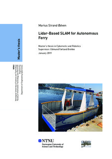
| dc.description.abstract | This thesis gives a survey of existing lidar-based simultaneous localization and mapping(SLAM) which might suit an autonomous ferry, describes a data-collecting experimentusing a half-scale prototype ferry, and presents and analyzes SLAM results. Three SLAMalgorithms available as open-source through the Robot Operating System (ROS) com-munity are run on the collected lidar-data. The data was acquired using a 3D lidar, aGNSS-receiver and an Inertial Navigation System serving as IMU. The experiment was setup such that the recorded data could be replayed to simulate various scenarios assumedlikely for an operational autonomous ferry for passengers. The output maps and poseestimates of the algorithms are run on different data-sets and are evaluated comparedto ground truth data. The results are evaluated, and either SLAM algorithm is deemedadequately suited to serve as a solution for an autonomous ferry. Ideas of what worksand what does not are discussed, however, and thus the thesis represents a foundation forwhich others can build towards a SLAM solution for said purpose. | |
| dc.language | eng | |
| dc.publisher | NTNU | |
| dc.title | Lidar-Based SLAM for AUtonomous Ferry | |
| dc.type | Master thesis | |
