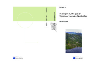
| dc.description.abstract | The 22nd of February 1756 the largest historically recorded rockslide in Norway took place at Tjelle in Langfjorden, Møre & Romsdal County. Three displacement waves of up to 50 meters were created in Langfjorden by the impact of the failed rock mass constituting the Tjellefonna rockslide. A total of 32 people were killed, and 168 houses and 196 boats around the fjord were destroyed.This thesis is continuation of a project assessment carried out in 2011, and comprises a back-analysis of the Tjellefonna rockslide. The ante-rockslide topography (ART) is reconstructed and a detailed volume calculation of the rockslide is carried out using two modern techniques: the Slope Local Base Level (SLBL) and a manual ART reconstruction in the PolyWorks software. The reconstructed pre-rockslide topography is then used in the 2D numerical modelling software Phase2, for a detailed study of the parameters and trigger factors that affected the slope stability. The volume of the deposits (on- and offshore) is calculated to be around 11 million m3, giving an initial volume of the rockslide between 9 to 10 million m3. This is less than the earlier calculations of 12 to 15 million m3, and could have consequences for previous rockslide-generated tsunami modelling (e.g. for the Åknes rock slope). The Phase2 analyses include shear strength reduction (SSR) investigations and sensitive parameter tests. It is demonstrated that the failure of the Tjellefonna slope must have required strain softening in combination with triggering factors, where high groundwater is an essential feature. Earthquake, on the other hand, is ruled out as a triggering factor. Additionally, the analyses show that a sub-horizontal structure is critical in order to induce slope instability. This could be represented either by the J5 joint set or an observed sub-horizontal fault, although fieldwork and modelling indicates that the fault is the most important.The sliding surface has been evaluated using the Phase2 and SLBL results. It is concluded that the Tjellefonna rockslide was not composed of a uniform plane, but of a complex surface consisting of joints, faults, foliation and intact rock bridges. Moreover, it is obvious that the Tjellefonna failure was closely related to the tectonic deformation of the rocks in this area. The failure was likely also a consequence of progressive accumulation of rock weakening (strain softening), acting to degrade the equilibrium state of the slope. This could have generated a hillside creep explaining the growing tension cracks observed at the present crown prior to the rockslide. | nb_NO |

