| dc.contributor.author | Danoedoro, Projo | |
| dc.contributor.author | Gupita, Diwyacitta Dirda | |
| dc.contributor.author | Afwani, Muhammad Zayyanul | |
| dc.contributor.author | Hadi, Haeydar Anggara | |
| dc.contributor.author | Mahendra, William Krista | |
| dc.date.accessioned | 2023-05-05T11:34:18Z | |
| dc.date.available | 2023-05-05T11:34:18Z | |
| dc.date.created | 2023-03-07T09:25:10Z | |
| dc.date.issued | 2022 | |
| dc.identifier.citation | Indonesian Journal of Geography. 2022, 54 (3), 333-343. | en_US |
| dc.identifier.issn | 0024-9521 | |
| dc.identifier.uri | https://hdl.handle.net/11250/3066448 | |
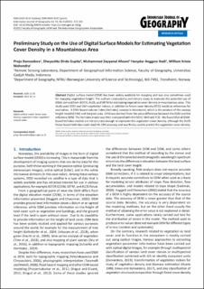
| dc.description.abstract | Digital surface model (DSM) has been widely available for mapping and was also sometimes used for mapping vegetation height. The authors conducted a preliminary study to evaluate the potential use of DSMs derived from ASTER, ALOS, and SRTM for estimating vegetation cover density in mountainous area. This study used NDVI and SAVI vegetation indices, in addition to forest cover density (FCD) model as references for evaluation. A DSM-based volume index (Volindex) concept is introduced, which is the product of the canopy height model (CHM) and the pixel area. CHM was derived from the value difference between the DSM and the reference DEM. The Volindex model was then compared with the NDVI, SAVI and FCD. We found that all DSM-based Volindex models are not accurate enough to represent the vegetation cover density, although the ALOS Palsar-based Volindex could reach 41.53% accuracy and was finally used to predict the vegetation cover density. | en_US |
| dc.language.iso | eng | en_US |
| dc.publisher | Universitas Gadjah Mada in collaboration with The Indonesian Geographers Association | en_US |
| dc.rights | Navngivelse-Ikkekommersiell 4.0 Internasjonal | * |
| dc.rights.uri | http://creativecommons.org/licenses/by-nc/4.0/deed.no | * |
| dc.title | Preliminary Study on the Use of Digital Surface Models for Estimating Vegetation Cover Density in a Mountainous Area | en_US |
| dc.title.alternative | Preliminary Study on the Use of Digital Surface Models for Estimating Vegetation Cover Density in a Mountainous Area | en_US |
| dc.type | Journal article | en_US |
| dc.type | Peer reviewed | en_US |
| dc.description.version | publishedVersion | en_US |
| dc.source.pagenumber | 333-343 | en_US |
| dc.source.volume | 54 | en_US |
| dc.source.journal | Indonesian Journal of Geography | en_US |
| dc.source.issue | 3 | en_US |
| dc.identifier.doi | 10.22146/IJG.60659 | |
| dc.identifier.cristin | 2131802 | |
| cristin.ispublished | true | |
| cristin.fulltext | original | |
| cristin.qualitycode | 1 | |

