| dc.contributor.author | Stamnes, Arne Anderson | |
| dc.contributor.author | Sauvage, Raymond | |
| dc.contributor.editor | Ellingsen, Ellen J. Grav | |
| dc.date.accessioned | 2017-02-08T12:18:42Z | |
| dc.date.available | 2017-02-08T12:18:42Z | |
| dc.date.created | 2017-01-10T13:46:10Z | |
| dc.date.issued | 2016 | |
| dc.identifier.isbn | 978-82-8322-081-0 | |
| dc.identifier.issn | 2387-3965 | |
| dc.identifier.uri | http://hdl.handle.net/11250/2429976 | |
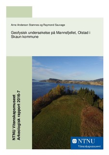
| dc.description.abstract | In August 2014 a metal detectorist discovered several objects from the Young Iron Age on the hill called Mannsfjellet at the Olstad-farm in Skaun municipality, Sør-Trøndelag County. This was followed by a small excavation performed by the NTNU University Museum in September/October the same year. This led to the finds of a Viking-Age sword and shield boss, as well as a leather pouch containing amongst other things several Arabic coins. Since it was assumed that this find was a remain from a larger collection of burials in the area, the NTNU University Museum performed a geophysical investigation and photogrammetric documentation on behalf of the Directorate for Cultural Heritage. This investigation was performed on the 18th and 19th of October. The objectives of this investigation was to: 1. Map the presence of dug features, their condition and status, 2. Map the thickness of the topsoil and 3. Map the spread of metal objects as detectable with a gradiometer. The investigation performed was a combination of a ground penetrating radar and gradiometer-surveys, as well as making a detailed landscape model by photogrammetry of aerial images photographed from a drone. The collected data was processed and analyzed to answer these objectives. No dug features relating such as pits or ditches relating to prehistoric activity was detected, but the radar survey detected a large amount of plough furrows which were in average at 20-50cm depth and down to about 10cm across. From this radar-dataset it was also possible to indicate the approximate depth of the topsoil, as well as the depth down to the bedrock in certain areas. The gradiometer survey revealed a strongly magnetic bedrock in parts of the investigation area. This prevented a possible detection of archaeological observation especially in the northern parts of the investigation area. In other parts of the area investigated with the gradiometer we could detect some anomalies interpreted as metal objects, but the position of these did not match known metal detecting hits from the 2014-investigation. The photogrammetry produced a highly detailed terrain model, but no microtopographical evidence revealed additional cultural historically interesting observations. It is assumed that any future ploughing will make the possibilities for in-situ documentation more difficult. | nb_NO |
| dc.language.iso | nob | nb_NO |
| dc.publisher | NTNU Vitenskapsmuseet | nb_NO |
| dc.relation.ispartof | NTNU Vitenskapsmuseet arkeologisk rapport | |
| dc.relation.ispartofseries | NTNU Vitenskapsmuseet arkeologisk rapport; | |
| dc.relation.ispartofseries | ;2016/7 | |
| dc.title | Geofysisk undersøkelse på Mannsfjellet, Olstad i Skaun kommune | nb_NO |
| dc.type | Research report | nb_NO |
| dc.source.pagenumber | 52 | nb_NO |
| dc.identifier.cristin | 1424265 | |
| cristin.unitcode | 194,31,5,0 | |
| cristin.unitname | Seksjon for arkeologi og kulturhistorie | |
| cristin.ispublished | true | |
| cristin.fulltext | original | |
